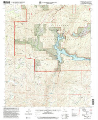
1997 Map of Barrett Lake
USGS Topo · Published 2000About this map
Barrett Lake and the Barrett Dam form the centerpiece of this terrain, where water management intersects with the steep canyons of the Cleveland National Forest. The landscape is defined by its drainage systems, from the confluence of Lawson Creek and Wilson Creek to the southwesterly flow of Cottonwood Creek. The presence of several historic homesteads and agricultural sites, including Eichenlaub Ranch and Bratton Ranch, suggests a long history of rural land use in these valleys.
Find a feature on this map
56 named features on this map. Tap any name to fly to it.
Don’t see what you’re looking for? This feature index may not catch every label — zoom into the map to look around manually.
Map Details
Editions of this 1997 Barrett Lake Map
This is the sole edition of this map. No revisions or reprints were ever made.
Other maps of this area

1893 · El Cajon
USGS Topo · 1:62,500

1901 · Elcajon
USGS Topo · 1:62,500

1903 · Cuyamaca
USGS Topo · 1:125,000

1903 · Elcajon
USGS Topo · 1:62,500

1904 · Southern California Sheet No. 2
USGS Topo · 1:250,000

1939 · El Cajon
USGS Topo · 1:62,500

1942 · Potrero
USGS Topo · 1:48,000

1942 · El Cajon
USGS Topo · 1:62,500

1942 · Cuyamaca Peak
USGS Topo · 1:62,500

1943 · Jamul
USGS Topo · 1:62,500