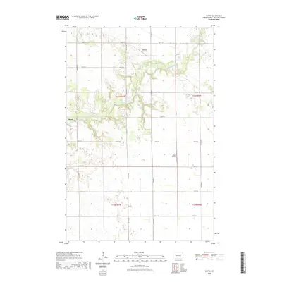
2020 Map of Barrie
USGS Topo · Published 2020About this map
The Sheyenne River cuts a winding path through the northern half of this North Dakota landscape, creating a distinct topographical break in an otherwise regular grid of section lines and gravel roads. In the township of Barrie, the namesake Barrie Cem serves as a local landmark near the river's southern banks. Further east, the Gol Cem overlooks the river valley from a northern plateau. This modern survey reflects the enduring rural character of Richland County, where transportation is defined by a network of numbered avenues and streets like Co Rd 3. Small-scale aviation markers including the Odegard Airport and Bakko Airstrip dot the plains, indicating the vast distances and agricultural logistics typical of this region.
Find a feature on this map
25 named features on this map. Tap any name to fly to it.
Don’t see what you’re looking for? This feature index may not catch every label — zoom into the map to look around manually.
Map Details
Editions of this 2020 Barrie Map
This is the sole edition of this map. No revisions or reprints were ever made.
Other maps of this area

1895 · Fargo
USGS Topo · 1:125,000

1895 · Casselton
USGS Topo · 1:125,000

1897 · Fargo
USGS Topo · 1:125,000

1897 · Casselton
USGS Topo · 1:125,000

1904 · Wahpeton
USGS Topo · 1:125,000

1907 · Wyndmere
USGS Topo · 1:125,000

1953 · Fargo
USGS Topo · 1:250,000

1956 · Fargo
USGS Topo · 1:250,000

1959 · Kindred
USGS Topo · 1:24,000

1959 · Leonard
USGS Topo · 1:24,000