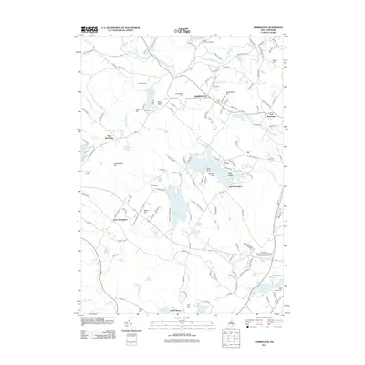
2012 Map of Barrington
USGS Topo · Published 2012About this map
Barrington and its outlying villages are defined by a complex network of waterways and hills in this early 21st-century landscape. The Isinglass River and Mallego Brook cut through the northern terrain, while the massive Mendums Pond and Nottingham Lake anchor the southern reaches. This era shows the continued importance of regional education and recreation, featuring the University of New Hampshire School of Continuing Studies and several established grounds like Camp Speedwell and Ayers Lake Campground. Genealogists can identify several family-named burial sites, including Clark Cem, Capon Cem, and Locke Cem, scattered near older settlements like West Barrington and East Barrington. The map also captures curiously named landmarks such as Bumfagging Hill and Mount Misery, alongside the rising elevations of Nippo Hill and Peaked Hill.
Find a feature on this map
154 named features on this map. Tap any name to fly to it.
Don’t see what you’re looking for? This feature index may not catch every label — zoom into the map to look around manually.
Map Details
Editions of this 2012 Barrington Map
This is the sole edition of this map. No revisions or reprints were ever made.
Other maps of this area

1891 · Berwick
USGS Topo · 1:62,500

1893 · Dover
USGS Topo · 1:62,500

1893 · Berwick
USGS Topo · 1:62,500

1916 · Dover
USGS Topo · 1:62,500

1917 · Mt. Pawtuckaway
USGS Topo · 1:62,500

1918 · Dover
USGS Topo · 1:62,500

1919 · Mt. Pawtuckaway
USGS Topo · 1:62,500

1919 · Alton
USGS Topo · 1:62,500

1933 · Berwick
USGS Topo · 1:48,000

1937 · Berwick
USGS Topo · 1:62,500