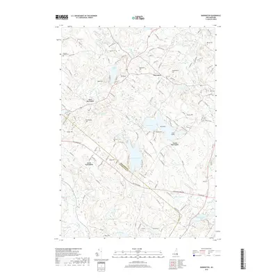
2018 Map of Barrington
USGS Topo · Published 2018About this map
Barrington and its surrounding villages of South Barrington, West Barrington, and North Nottingham are defined by a complex network of glacial ponds and drainages along the Isinglass River. The landscape is dotted with numerous family cemeteries, including the Hanson Cem, Shackford-Jenness Cem, and Locke Cem, offering significant value for genealogical research in Strafford County. Water bodies like Swains Lake, Mendums Pond, and Wheelwright Pond dominate the topography, interspersed with distinctive local landmarks such as Bumfagging Hill and Mt Misery. This 2018 survey reveals a settlement pattern where modern residential roads like Golf Course Way and Hearthside Dr weave between older routes and established farmstead sites. The crossing of the Bellamy River and various brooks like Mallego Brook and Spruce Brook underscores the historical importance of water power and drainage in this New Hampshire corridor.
Find a feature on this map
142 named features on this map. Tap any name to fly to it.
Don’t see what you’re looking for? This feature index may not catch every label — zoom into the map to look around manually.
Map Details
Editions of this 2018 Barrington Map
This is the sole edition of this map. No revisions or reprints were ever made.
Other maps of this area

1891 · Berwick
USGS Topo · 1:62,500

1893 · Dover
USGS Topo · 1:62,500

1893 · Berwick
USGS Topo · 1:62,500

1916 · Dover
USGS Topo · 1:62,500

1917 · Mt. Pawtuckaway
USGS Topo · 1:62,500

1918 · Dover
USGS Topo · 1:62,500

1919 · Mt. Pawtuckaway
USGS Topo · 1:62,500

1919 · Alton
USGS Topo · 1:62,500

1933 · Berwick
USGS Topo · 1:48,000

1937 · Berwick
USGS Topo · 1:62,500