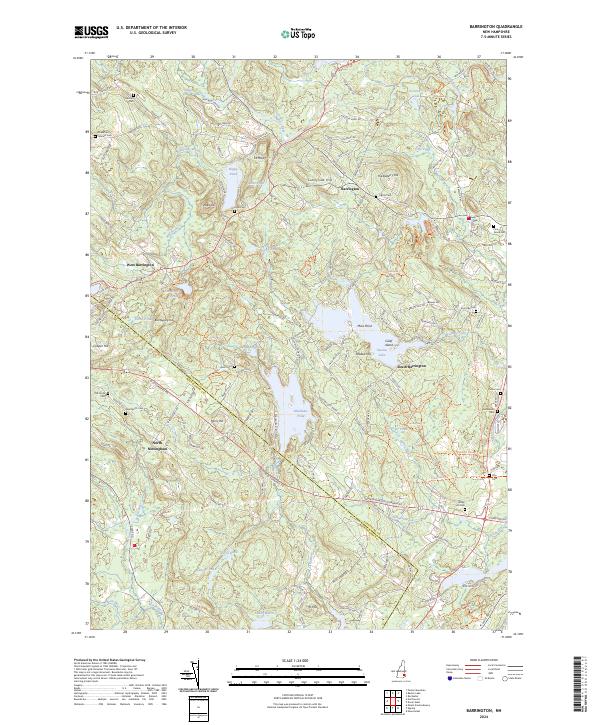
2024 Map of Barrington
USGS Topo · Published 2024About this map
The Isinglass River and Bellamy River networks define the varied landscape of Strafford and Rockingham Counties, where the transition from lakefront properties to rural woodlots reflects the area's mid-century development. Large water bodies like Swains Lake and Mendums Pond serve as central landmarks, surrounded by family-named terrain such as Bumfagging Hill and Huckleberry Hill. The map meticulously records the intersection of colonial history and modern habitation, preserved in the distribution of family burial grounds like the Shackford Jenness Cem and Hanson Cem.
Find a feature on this map
126 named features on this map. Tap any name to fly to it.
Don’t see what you’re looking for? This feature index may not catch every label — zoom into the map to look around manually.
Map Details
Editions of this 2024 Barrington Map
This is the sole edition of this map. No revisions or reprints were ever made.
Other maps of this area

1891 · Berwick
USGS Topo · 1:62,500

1893 · Dover
USGS Topo · 1:62,500

1893 · Berwick
USGS Topo · 1:62,500

1916 · Dover
USGS Topo · 1:62,500

1917 · Mt. Pawtuckaway
USGS Topo · 1:62,500

1918 · Dover
USGS Topo · 1:62,500

1919 · Mt. Pawtuckaway
USGS Topo · 1:62,500

1919 · Alton
USGS Topo · 1:62,500

1933 · Berwick
USGS Topo · 1:48,000

1937 · Berwick
USGS Topo · 1:62,500