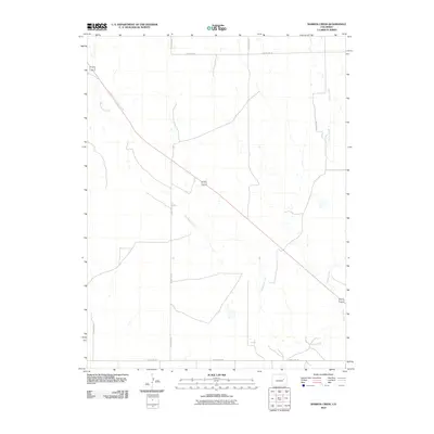
2010 Map of Barron Creek
USGS Topo · Published 2010About this map
Big Sandy Creek meanders through this portion of Lincoln County, defining the drainage patterns of an open Colorado landscape. The hydrology of the area is further marked by Barron Creek, which cuts across the eastern reaches of the quadrangle. The map reflects a structured rural grid, where transportation is dictated by long-distance routes like County Rd-26 and County Rd-28. The diagonal path of Highway 40 287 provides a sharp contrast to the cardinal orientation of the local county roads, serving as a primary corridor through this high plains region. This 2010 survey illustrates the sparsely populated nature of the territory, where the intersection of watercourses and the section-line road network remains the primary focus of land organization.
Find a feature on this map
9 named features on this map. Tap any name to fly to it.
Don’t see what you’re looking for? This feature index may not catch every label — zoom into the map to look around manually.
Map Details
Editions of this 2010 Barron Creek Map
This is the sole edition of this map. No revisions or reprints were ever made.
Other maps of this area

1891 · Limon
USGS Topo · 1:125,000

1892 · Limon
USGS Topo · 1:125,000

1954 · Limon
USGS Topo · 1:250,000

1957 · Limon
USGS Topo · 1:250,000

1958 · Limon
USGS Topo · 1:250,000

1970 · Limon
USGS Topo · 1:24,000

1970 · Four Corners
USGS Topo · 1:24,000
1970 · Long Creek
USGS Topo · 1:24,000
1979 · Barron Creek
USGS Topo · 1:24,000

1979 · Genoa East
USGS Topo · 1:24,000