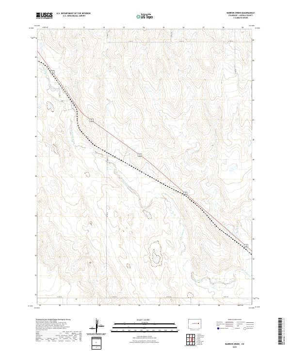
2022 Map of Barron Creek
USGS Topo · Published 2022About this map
Big Sandy Creek defines the low-lying drainage of this Lincoln County landscape, meandering southeast across an open terrain shaped by seasonal watercourses. The 2022 survey documents a sparsely settled region where the movement of water and the grid of county roads dictate the local geography. In addition to the primary creek, smaller tributaries like Barron Cr and the shorter Big Sandy Cr segment reveal the underlying hydrology of the high plains. The landscape is structured by a rectilinear road network, including Co Rd 26 and Co Rd 30, which provide the primary access through this agricultural and ranching territory. This edition offers a precise view of the rural infrastructure and land divisions within several townships, including t10s r55w and t9s r56w, capturing the area as it exists in the early twenty-first century.
Find a feature on this map
14 named features on this map. Tap any name to fly to it.
Don’t see what you’re looking for? This feature index may not catch every label — zoom into the map to look around manually.
Map Details
Editions of this 2022 Barron Creek Map
This is the sole edition of this map. No revisions or reprints were ever made.
Other maps of this area

1891 · Limon
USGS Topo · 1:125,000

1892 · Limon
USGS Topo · 1:125,000

1954 · Limon
USGS Topo · 1:250,000

1957 · Limon
USGS Topo · 1:250,000

1958 · Limon
USGS Topo · 1:250,000

1970 · Limon
USGS Topo · 1:24,000

1970 · Four Corners
USGS Topo · 1:24,000
1970 · Long Creek
USGS Topo · 1:24,000
1979 · Barron Creek
USGS Topo · 1:24,000

1979 · Genoa East
USGS Topo · 1:24,000