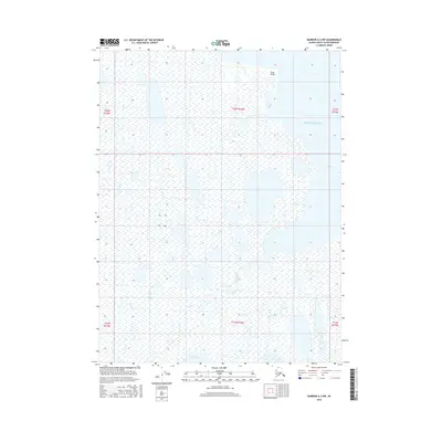
2016 Map of Barrow A-3 NW
USGS Topo · Published 2016About this map
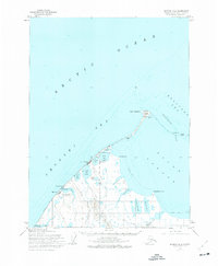
Lake Tusikvoak dominates the southern landscape of this Arctic coastal region, feeding a network of waterways that define the North Slope's complex hydrology. The map illustrates the jagged meeting of land and water where the Beaufort Sea enters Avak Bay and Iko Bay, separated by the prominent coastal landmark of Scott Point. This low-lying tundra environment is etched with the wandering course of Avak Creek, showing the drainage patterns characteristic of the Alaskan permafrost. The absence of roads or settlements emphasizes the pristine nature of this maritime wilderness, while the detailed hydrographic data captures the seasonal pulse of the Arctic shoreline.
Find a feature on this map
12 named features on this map. Tap any name to fly to it.
Don’t see what you’re looking for? This feature index may not catch every label — zoom into the map to look around manually.
Map Details
Editions of this 2016 Barrow A-3 NW Map
This is the sole edition of this map. No revisions or reprints were ever made.
Other maps of this area

1945 · Barrow
USGS Topo · 1:250,000

1949 · Barrow
USGS Topo · 1:250,000

1955 · Barrow
USGS Topo · 1:250,000

1955 · Barrow B-4
USGS Topo · 1:63,360

1955 · Barrow A-4
USGS Topo · 1:63,360

1955 · Barrow A-3
USGS Topo · 1:63,360
1955 · Barrow B-3
USGS Topo · 1:63,360
1962 · Barrow B-4
USGS Topo · 1:50,000
1962 · Barrow A-4
USGS Topo · 1:50,000
1973 · Barrow B-4
USGS Topo · 1:63,360