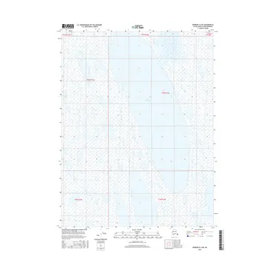
2016 Map of Barrow A-3 SW
USGS Topo · Published 2016About this map
Lake Tusikvoak dominates the central portion of this North Slope landscape, situated within a vast network of wetlands and seasonal water bodies. This 2016 survey, produced by the U.S. Geological Survey in cooperation with the Alaska Dept. of Transportation, delineates the Public Land Survey System grid across a largely trackless Arctic environment. The map details several townships including t20n r16w and t19n r17w, highlighting the intricate hydrology of the region north of the Arctic Circle. The character of the terrain is defined by its low relief and the complex distribution of surface water typical of the coastal plain, providing a technical record of the shoreline and drainage patterns before further environmental shifts.
Find a feature on this map
8 named features on this map. Tap any name to fly to it.
Don’t see what you’re looking for? This feature index may not catch every label — zoom into the map to look around manually.
Map Details
Editions of this 2016 Barrow A-3 SW Map
This is the sole edition of this map. No revisions or reprints were ever made.
Other maps of this area

1945 · Barrow
USGS Topo · 1:250,000

1949 · Barrow
USGS Topo · 1:250,000

1951 · Meade River
USGS Topo · 1:250,000

1951 · Teshekpuk
USGS Topo · 1:250,000

1955 · Barrow
USGS Topo · 1:250,000

1955 · Teshekpuk
USGS Topo · 1:250,000

1955 · Meade River
USGS Topo · 1:250,000

1955 · Barrow A-4
USGS Topo · 1:63,360

1955 · Barrow A-3
USGS Topo · 1:63,360
1955 · Teshekpuk D-5
USGS Topo · 1:63,360