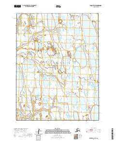
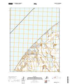
2020 Map of Barrow A-4 NW
USGS Topo · Published 2020About this map
Utqiaġvik serves as the northern anchor for this landscape of thaw-lake plains on the Arctic coast. The terrain is defined by an intricate network of water bodies, most notably the large basins of Ikroavik Lake and Pingoakeok Lake. This recent survey reveals a classic thermokarst landscape, where the shifting ground creates shallow, oriented lakes such as Emaiksoun Lake and Kimouksik Lake across the North Slope. The pattern of these lakes, many of which follow a distinct north-south elongation, reflects the ongoing geomorphic processes of the permafrost. Surveyed under the t22n r18w and t22n r19w townships, the map documents a remote stretch of the Alaskan Tundra before it meets the Beaufort Sea to the north.
Find a feature on this map
9 named features on this map. Tap any name to fly to it.
Don’t see what you’re looking for? This feature index may not catch every label — zoom into the map to look around manually.
Map Details
Editions of this 2020 Barrow A-4 NW Map
This is the sole edition of this map. No revisions or reprints were ever made.
Other maps of this area

1945 · Barrow
USGS Topo · 1:250,000

1949 · Barrow
USGS Topo · 1:250,000

1955 · Barrow
USGS Topo · 1:250,000

1955 · Barrow B-4
USGS Topo · 1:63,360

1955 · Barrow A-4
USGS Topo · 1:63,360

1955 · Barrow A-5
USGS Topo · 1:63,360
1962 · Barrow B-4
USGS Topo · 1:50,000
1962 · Barrow A-4
USGS Topo · 1:50,000
1973 · Barrow B-4
USGS Topo · 1:63,360
2020 · Barrow B-4 SW
USGS Topo · 1:25,000