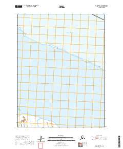
2020 Map of Barrow B-3 SW
USGS Topo · Published 2020About this map
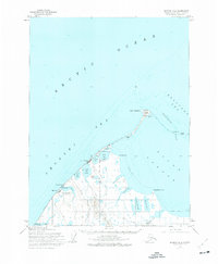
The Plover Islands and Tapkaluk Islands form a narrow, shifting barrier chain along the northern coast of Alaska in this modern survey. This thin ribbon of land separates the open waters of the Beaufort Sea from the protected reaches of Elson Lagoon. The landscape is dominated by these dynamic coastal features, including Deadmans Island and Crescent Island, which are subject to the intense maritime forces of the Arctic. The map illustrates the fragile relationship between the ocean and the lagoon system, providing a precise record of the shoreline and maritime boundaries within the North Slope Borough. This specialized view focuses on the remote intersection of the sea and the coastal plain, where shifting sands and tides continuously reshape the land.
Find a feature on this map
11 named features on this map. Tap any name to fly to it.
Don’t see what you’re looking for? This feature index may not catch every label — zoom into the map to look around manually.
Map Details
Editions of this 2020 Barrow B-3 SW Map
This is the sole edition of this map. No revisions or reprints were ever made.
Other maps of this area

1945 · Barrow
USGS Topo · 1:250,000

1949 · Barrow
USGS Topo · 1:250,000

1955 · Barrow
USGS Topo · 1:250,000

1955 · Barrow B-4
USGS Topo · 1:63,360

1955 · Barrow A-4
USGS Topo · 1:63,360

1955 · Barrow A-3
USGS Topo · 1:63,360
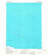
1955 · Barrow B-3
USGS Topo · 1:63,360
1962 · Barrow B-4
USGS Topo · 1:50,000
1962 · Barrow A-4
USGS Topo · 1:50,000
1973 · Barrow B-4
USGS Topo · 1:63,360