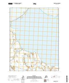
2020 Map of Barrow B-4 SE
USGS Topo · Published 2020About this map
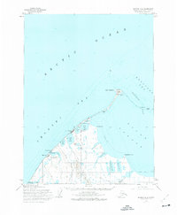
Agsinoralak Beach and Arigitivik Beach stretch along the northwestern coast where the Chukchi Sea meets the northernmost reaches of Alaska. This coastal landscape is defined by its barrier islands and narrow spits, including Doctor Island and Crescent Island, which separate the open sea from the calmer waters of Elson Lagoon. Further inland, the terrain transitions into a complex system of wetlands and coastal tundra, marked by features such as West Twin Lake and East Twin Lake. Small coastal access points like Niksirok Point and Tikigaruk Point are connected by local routes like Stevenson Street, while the southern reaches of the map show the meandering path of the Mayoeak River as it flows toward the lagoon.
Find a feature on this map
25 named features on this map. Tap any name to fly to it.
Don’t see what you’re looking for? This feature index may not catch every label — zoom into the map to look around manually.
Map Details
Editions of this 2020 Barrow B-4 SE Map
This is the sole edition of this map. No revisions or reprints were ever made.
Other maps of this area

1945 · Barrow
USGS Topo · 1:250,000

1949 · Barrow
USGS Topo · 1:250,000

1955 · Barrow
USGS Topo · 1:250,000

1955 · Barrow B-4
USGS Topo · 1:63,360

1955 · Barrow A-4
USGS Topo · 1:63,360

1955 · Barrow A-3
USGS Topo · 1:63,360
1955 · Barrow B-3
USGS Topo · 1:63,360
1962 · Barrow B-4
USGS Topo · 1:50,000
1962 · Barrow A-4
USGS Topo · 1:50,000
1973 · Barrow B-4
USGS Topo · 1:63,360