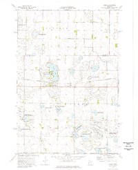
1974 Map of Barry
USGS Topo · Published 1976About this map
Barry serves as the central hub of this prairie landscape, situated along the Burlington Northern railroad line. The surrounding terrain of Browns Valley is defined by an extensive network of conservation lands and managed wetlands, including the Allen State Wildlife Management Area and the Mallard Hole State Wildlife Management Area. These protected zones, interspersed with the waters of Barry Lake and Fogarty Lake, suggest a mid-1970s environment deeply committed to waterfowl production and wildlife preservation.
Find a feature on this map
20 named features on this map. Tap any name to fly to it.
Don’t see what you’re looking for? This feature index may not catch every label — zoom into the map to look around manually.
Map Details
Editions of this 1974 Barry Map
This is the sole edition of this map. No revisions or reprints were ever made.
Other maps of this area

1916 · Beardsley
USGS Topo · 1:62,500

1918 · Beardsley
USGS Topo · 1:62,500

1950 · Graceville
USGS Topo · 1:62,500

1953 · Ortonville
USGS Topo · 1:62,500

1953 · Milbank
USGS Topo · 1:250,000

1954 · Big Stone Lake
USGS Topo · 1:62,500

1958 · Milbank
USGS Topo · 1:250,000

1971 · Big Stone Lake East
USGS Topo · 1:24,000

1971 · Big Stone Lake West
USGS Topo · 1:24,000
1971 · Clinton
USGS Topo · 1:24,000