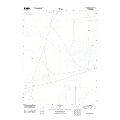
2012 Map of Bartine Ranch
USGS Topo · Published 2012About this map
Bartine Ranch serves as a primary point of reference in this arid region of central Nevada, where the landscape is defined by its vital water sources and significant relief. The presence of Hot Springs and Hot Spring Hill suggests geothermal activity that has long shaped the local geography. Several seasonal and perennial watercourses, including Coils Creek, Roberts Creek, and Slough Creek, descend from the higher elevations of Lone Mountain to feed into the broader Antelope Wash. These drainages, along with Lone Mountain Spring and Clover Spring, were historically essential for ranching operations and travelers navigating the high desert. The network of tracks and roads, such as Antelope Valley Rd, illustrates the continued reliance on these natural corridors through the Great Basin terrain.
Find a feature on this map
12 named features on this map. Tap any name to fly to it.
Don’t see what you’re looking for? This feature index may not catch every label — zoom into the map to look around manually.
Map Details
Editions of this 2012 Bartine Ranch Map
This is the sole edition of this map. No revisions or reprints were ever made.
Other maps of this area

1926 · Roberts Mountains
USGS Topo · 1:250,000

1929 · Roberts Mountains
USGS Topo · 1:250,000

1955 · Millett
USGS Topo · 1:250,000

1956 · Bellevue Peak
USGS Topo · 1:62,500

1956 · Bartine Ranch
USGS Topo · 1:62,500

1956 · Antelope Peak
USGS Topo · 1:62,500

1956 · Whistler Mtn
USGS Topo · 1:62,500

1959 · Millett
USGS Topo · 1:250,000

1978 · Summit Mountain
USGS Topo · 1:100,000

1979 · Simpson Park Mtns
USGS Topo · 1:100,000