
1956 Map of Antelope Peak
USGS Topo · Published 1957About this map
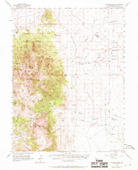
Ardans Ranch and Morrison Ranch stand as isolated outposts within the high desert landscape of Toiyabe National Forest during the mid-1950s. The geography is defined by the significant elevations of the Monitor Range, where peaks like Summit Mtn and Antelope Peak tower over deep drainages including Hodges Canyon and Brock Canyon. Water is the lifeblood of this arid region, evidenced by the cluster of reliable sources such as Dagget Spring, Sullivan Spring, and the Artesian Well located near Kitchen Meadow.
Find a feature on this map
62 named features on this map. Tap any name to fly to it.
Don’t see what you’re looking for? This feature index may not catch every label — zoom into the map to look around manually.
Map Details
Editions of this 1956 Antelope Peak Map
3 editions found
Other maps of this area

1926 · Roberts Mountains
USGS Topo · 1:250,000

1929 · Roberts Mountains
USGS Topo · 1:250,000

1955 · Millett
USGS Topo · 1:250,000

1956 · Bellevue Peak
USGS Topo · 1:62,500

1956 · Bartine Ranch
USGS Topo · 1:62,500

1956 · Cockalorum Wash
USGS Topo · 1:62,500

1956 · Horse Heaven Mtn
USGS Topo · 1:62,500

1956 · Whistler Mtn
USGS Topo · 1:62,500

1956 · Ackerman Canyon
USGS Topo · 1:62,500

1959 · Millett
USGS Topo · 1:250,000