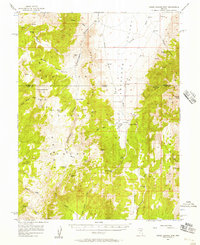
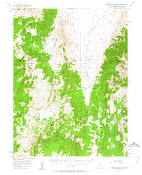
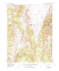
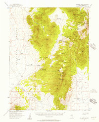
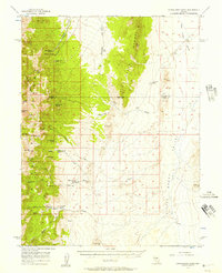
1956 Map of Horse Heaven Mtn
USGS Topo · Published 1957About this map
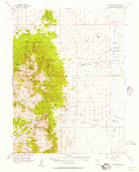
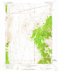
Monitor Range dominates the western portion of this mid-century survey, defining the high-altitude geography of central Nevada along the boundary of Eureka and Nye counties. The landscape is characterized by a network of steep drainages like Copenhagen Canyon and Ryegrass Canyon that descend toward the broad Antelope Valley to the east. Isolated springs and wells provide the lifeblood for high-desert ranching, supporting established sites like Martin Ranch and Segura Ranch.
Find a feature on this map
58 named features on this map. Tap any name to fly to it.
Don’t see what you’re looking for? This feature index may not catch every label — zoom into the map to look around manually.
Map Details
Editions of this 1956 Horse Heaven Mtn Map
3 editions found
Other maps of this area

1926 · Roberts Mountains
USGS Topo · 1:250,000

1929 · Roberts Mountains
USGS Topo · 1:250,000

1955 · Millett
USGS Topo · 1:250,000
1956 · Bellevue Peak
USGS Topo · 1:62,500
1956 · Cockalorum Wash
USGS Topo · 1:62,500
1956 · Antelope Peak
USGS Topo · 1:62,500

1956 · Tonopah
USGS Topo · 1:250,000

1959 · Tonopah
USGS Topo · 1:250,000

1959 · Millett
USGS Topo · 1:250,000
1960 · Hickison Summit
USGS Topo · 1:62,500