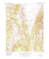
1956 Map of Horse Heaven Mtn
USGS Topo · Published 1975About this map
Horse Heaven National Forest dominates this mid-century survey of the high desert along the Eureka and Nye County line. The landscape is defined by the sharp transition between the Antelope Range and the broad expanse of Antelope Valley, where human presence is sparse and strategically tied to water sources. These small foothill outposts, such as Martin Ranch and Segura Ranch, represent the enduring ranching economy of the Great Basin during the 1950s. High-elevation points like Horse Heaven Mtn and Ninemile Peak overlook a network of seasonal drainages, including White Rock Creek and Dry Valley Creek. The map provides specific locations for numerous mountain springs, such as Oakie Spring and Applebush Hill Spr, which were essential for both livestock and early travelers. Notable landmarks like Rabbit Hill and the Butler Basin offer a detailed look at the complex topography of the region's canyons.
Find a feature on this map
59 named features on this map. Tap any name to fly to it.
Don’t see what you’re looking for? This feature index may not catch every label — zoom into the map to look around manually.
Map Details
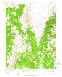
Editions of this 1956 Horse Heaven Mtn Map
3 editions found
Other maps of this area

1926 · Roberts Mountains
USGS Topo · 1:250,000

1929 · Roberts Mountains
USGS Topo · 1:250,000

1955 · Millett
USGS Topo · 1:250,000

1956 · Bellevue Peak
USGS Topo · 1:62,500

1956 · Cockalorum Wash
USGS Topo · 1:62,500

1956 · Horse Heaven Mtn
USGS Topo · 1:62,500

1956 · Antelope Peak
USGS Topo · 1:62,500

1956 · Tonopah
USGS Topo · 1:250,000

1959 · Tonopah
USGS Topo · 1:250,000

1959 · Millett
USGS Topo · 1:250,000