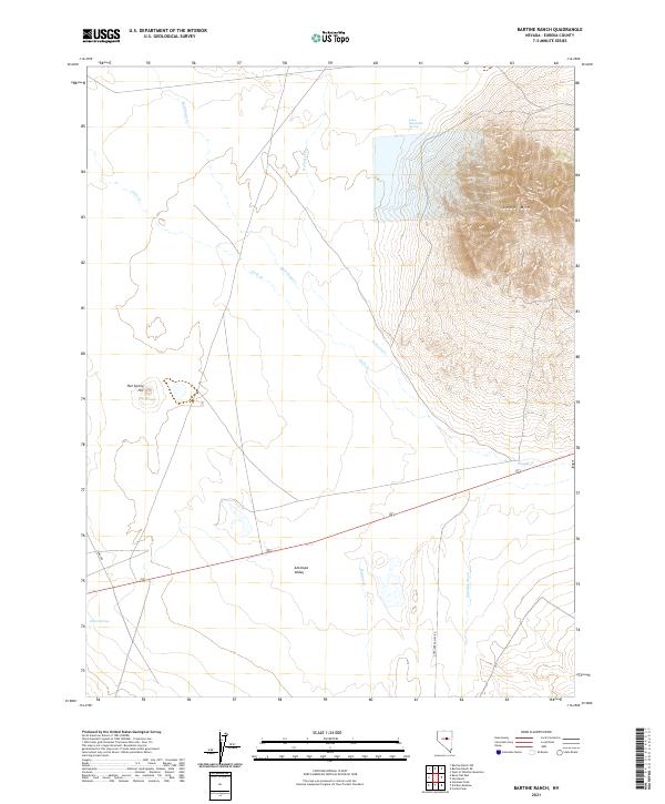
2021 Map of Bartine Ranch
USGS Topo · Published 2021About this map
Lone Mtn dominates the northeastern landscape of this high-desert region, a significant topographical landmark that transitions into the broad expanse of Antelope Valley to the south. This area in Eureka County is defined by its vital water sources, including Hot Springs and Lone Mountain Spring, which have long anchored human activity in this arid environment. The map details a network of ephemeral and perennial watercourses such as Rutabaga Cr, Roberts Cr, and Coils Cr that drain the slopes toward the valley floor. Historical routes like 3 Bars RD and Antelope Valley RD traverse the terrain, indicating the ranching and transit patterns established over decades. Other localized landmarks like Hot Spring Hill and Clover Spring provide specific points of interest for those tracing the history of land use and water rights in this part of Nevada.
Find a feature on this map
18 named features on this map. Tap any name to fly to it.
Don’t see what you’re looking for? This feature index may not catch every label — zoom into the map to look around manually.
Map Details
Editions of this 2021 Bartine Ranch Map
This is the sole edition of this map. No revisions or reprints were ever made.
Other maps of this area

1926 · Roberts Mountains
USGS Topo · 1:250,000

1929 · Roberts Mountains
USGS Topo · 1:250,000

1955 · Millett
USGS Topo · 1:250,000

1956 · Bellevue Peak
USGS Topo · 1:62,500

1956 · Bartine Ranch
USGS Topo · 1:62,500

1956 · Antelope Peak
USGS Topo · 1:62,500

1956 · Whistler Mtn
USGS Topo · 1:62,500

1959 · Millett
USGS Topo · 1:250,000

1978 · Summit Mountain
USGS Topo · 1:100,000

1979 · Simpson Park Mtns
USGS Topo · 1:100,000