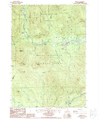
1987 Map of Bartlett
USGS Topo · Published 1987About this map
The Saco River valley forms the primary corridor of settlement and transport through this mountain landscape, centered on the village of Bartlett. The township is surrounded by the significant protected terrain of the White Mountain National Forest and the Presidential Range-Dry River Wilderness Area. To the west, the former logging center of Livermore and the small station at Sawyers River illustrate the era's reliance on the mountain-and-river geography for industry.
Find a feature on this map
57 named features on this map. Tap any name to fly to it.
Don’t see what you’re looking for? This feature index may not catch every label — zoom into the map to look around manually.
Map Details
Editions of this 1987 Bartlett Map
This is the sole edition of this map. No revisions or reprints were ever made.
Other maps of this area

1894 · North Conway
USGS Topo · 1:62,500

1895 · Crawford Notch
USGS Topo · 1:62,500

1896 · Crawford Notch
USGS Topo · 1:62,500

1896 · North Conway
USGS Topo · 1:62,500

1930 · Ossipee Lake
USGS Topo · 1:62,500

1931 · Mt. Chocorua
USGS Topo · 1:62,500

1942 · North Conway
USGS Topo · 1:62,500

1945 · North Conway
USGS Topo · 1:62,500

1946 · Crawford Notch
USGS Topo · 1:62,500

1949 · Portland
USGS Topo · 1:250,000