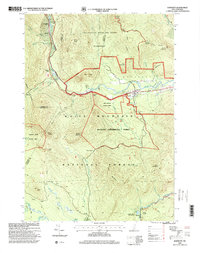
1995 Map of Bartlett
USGS Topo · Published 2000About this map
Bartlett stands as the primary settlement in this mountain corridor during the mid-1990s, situated where the Saco River bends eastward through the valley. The landscape is defined by the extensive White Mountain National Forest, containing specialized zones like the Bartlett Experimental Forest and the Sawyer Pond Scenic Area. A complex network of old logging roads and mountain paths, including the Sawyer River Road and Brunel Trail, crisscrosses the high elevations between peaks like Mount Tremont and Mount Parker. In the southern portion of the map, the Kancamagus Scenic Byway follows the course of the Swift River through Rocky Gorge Scenic Area. The presence of the Cem near the main town and the small settlement of Livermore to the west provides valuable reference points for local history and land-use studies.
Find a feature on this map
52 named features on this map. Tap any name to fly to it.
Don’t see what you’re looking for? This feature index may not catch every label — zoom into the map to look around manually.
Map Details
Editions of this 1995 Bartlett Map
This is the sole edition of this map. No revisions or reprints were ever made.
Other maps of this area

1894 · North Conway
USGS Topo · 1:62,500

1895 · Crawford Notch
USGS Topo · 1:62,500

1896 · Crawford Notch
USGS Topo · 1:62,500

1896 · North Conway
USGS Topo · 1:62,500

1930 · Ossipee Lake
USGS Topo · 1:62,500

1931 · Mt. Chocorua
USGS Topo · 1:62,500

1942 · North Conway
USGS Topo · 1:62,500

1945 · North Conway
USGS Topo · 1:62,500

1946 · Crawford Notch
USGS Topo · 1:62,500

1949 · Portland
USGS Topo · 1:250,000