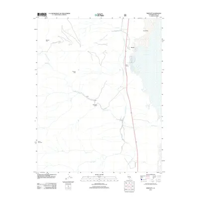
2012 Map of Bartlett
USGS Topo · Published 2012About this map
Bartlett sits along the western shoreline of Owens Lake, a landscape defined by the engineered transport of water and the imposing peaks of the Sierra Nevada. The Los Angeles Aqueduct runs parallel to the shore, cutting a line between the lake bed and the rising foothills. This infrastructure, including the LA Aqueduct segment, represents the mid-century Water Wars legacy that transformed this region's hydrology.
Find a feature on this map
22 named features on this map. Tap any name to fly to it.
Don’t see what you’re looking for? This feature index may not catch every label — zoom into the map to look around manually.
Map Details
Editions of this 2012 Bartlett Map
This is the sole edition of this map. No revisions or reprints were ever made.
Other maps of this area

1905 · Olancha
USGS Topo · 1:125,000

1907 · Olancha
USGS Topo · 1:125,000

1907 · Mt. Whitney
USGS Topo · 1:125,000

1908 · Ballarat
USGS Topo · 1:250,000

1913 · Ballarat
USGS Topo · 1:250,000

1919 · Mt. Whitney
USGS Topo · 1:125,000

1937 · Mt. Whitney
USGS Topo · 1:125,000

1948 · Death Valley
USGS Topo · 1:250,000

1948 · Fresno
USGS Topo · 1:250,000

1950 · New York Butte
USGS Topo · 1:62,500