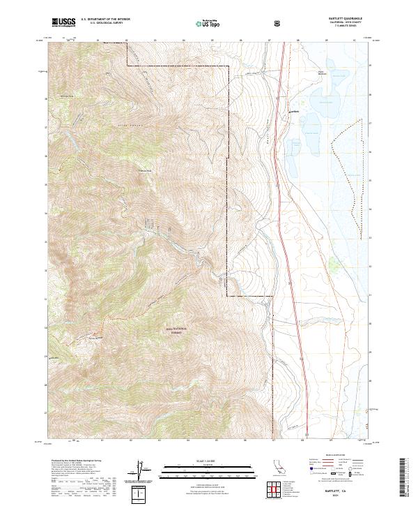
2021 Map of Bartlett
USGS Topo · Published 2021About this map
The settlement of Bartlett sits at the edge of the expansive Owens Lake bed, a landscape defined by dramatic elevation changes from the valley floor up into the eastern Sierra Nevada. This 2021 survey shows the critical infrastructure of the L A Aqueduct, which skirts the base of the mountains to capture runoff. The terrain to the west is dominated by the Inyo National Forest, where steep canyons like Slide Canyon and Wormhole Canyon descend from high summits such as Wonoga Peak and Muah Mtn. Ancient travel routes and modern access are visible via Old Cottonwood Canyon Rd and the Wormhole Canyon Trail, providing a look at how water management and recreation coexist in this arid environment. Significant drainage systems, including Cottonwood Creek and Ash Creek, flow eastward toward the lake from the high peaks of the Timosea Peak area.
Find a feature on this map
35 named features on this map. Tap any name to fly to it.
Don’t see what you’re looking for? This feature index may not catch every label — zoom into the map to look around manually.
Map Details
Editions of this 2021 Bartlett Map
This is the sole edition of this map. No revisions or reprints were ever made.
Other maps of this area

1905 · Olancha
USGS Topo · 1:125,000

1907 · Olancha
USGS Topo · 1:125,000

1907 · Mt. Whitney
USGS Topo · 1:125,000

1908 · Ballarat
USGS Topo · 1:250,000

1913 · Ballarat
USGS Topo · 1:250,000

1919 · Mt. Whitney
USGS Topo · 1:125,000

1937 · Mt. Whitney
USGS Topo · 1:125,000

1948 · Death Valley
USGS Topo · 1:250,000

1948 · Fresno
USGS Topo · 1:250,000

1950 · New York Butte
USGS Topo · 1:62,500