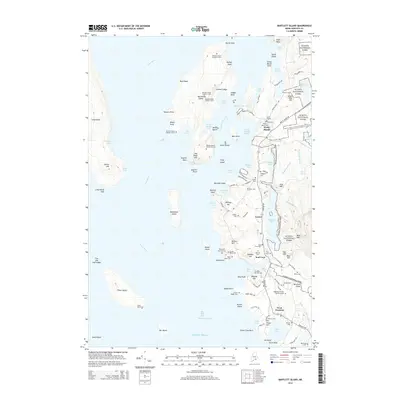
2014 Map of Bartlett Island
USGS Topo · Published 2014About this map
The rocky coastline and inner islands of Blue Hill Bay Eastern Passage define this section of the Maine coast, where the boundaries of Acadia National Park intermingle with historic coastal villages. On Bartlett Island, a sequence of family burial sites such as Bartlett Island Number 2 Cem and Bartlett Island Number 5 Cem indicate a history of settlement and private ownership separate from the mainland. Shoreline communities like Pretty Marsh and Seal Cove are centers of local life, characterized by narrow roads like Tremont Rd and Pretty Marsh Rd that follow the topography of the peninsulas. Genealogists will find a high density of small family plots and community graveyards, including the Babbidge Murphy Burial Ground and Smith Graves, documenting generations of residents in the West Tremont and Center areas.
Find a feature on this map
129 named features on this map. Tap any name to fly to it.
Don’t see what you’re looking for? This feature index may not catch every label — zoom into the map to look around manually.
Map Details
Editions of this 2014 Bartlett Island Map
This is the sole edition of this map. No revisions or reprints were ever made.
Other maps of this area

1904 · Deer Isle
USGS Topo · 1:62,500

1904 · Mount Desert
USGS Topo · 1:62,500

1904 · Swan Island
USGS Topo · 1:62,500

1904 · Bluehill
USGS Topo · 1:62,500

1905 · Penobscot Bay
USGS Topo · 1:125,000

1942 · Mount Desert
USGS Topo · 1:62,500

1942 · Deer Isle
USGS Topo · 1:62,500

1943 · Swans Island
USGS Topo · 1:62,500

1944 · Blue Hill
USGS Topo · 1:62,500

1944 · Deer Isle
USGS Topo · 1:62,500