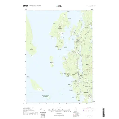
2021 Map of Bartlett Island
USGS Topo · Published 2021About this map
Bartlett Island and the western edge of Mount Desert Island anchor this coastal survey, where the rugged shoreline is defined by narrow passages like Bartlett Narrows and the waters of Blue Hill Bay. The landscape is a mosaic of conservation land and small coastal settlements, with sections of Acadia National Park protecting the higher ground of Bernard Mtn and Bald Mtn. For local historians, the map is remarkably dense with burial sites, including family-named locations such as Smith Graves, Pray Cem, and the Babbidge Murphy Burial Ground. These small, scattered cemeteries reflect the deep-rooted settlement patterns of Pretty Marsh and Seal Cove, where roads like Pretty Marsh Rd and Tremont Rd connect established communities with the surrounding timber and coastal landscape.
Find a feature on this map
133 named features on this map. Tap any name to fly to it.
Don’t see what you’re looking for? This feature index may not catch every label — zoom into the map to look around manually.
Map Details
Editions of this 2021 Bartlett Island Map
This is the sole edition of this map. No revisions or reprints were ever made.
Other maps of this area

1904 · Deer Isle
USGS Topo · 1:62,500

1904 · Mount Desert
USGS Topo · 1:62,500

1904 · Swan Island
USGS Topo · 1:62,500

1904 · Bluehill
USGS Topo · 1:62,500

1905 · Penobscot Bay
USGS Topo · 1:125,000

1942 · Mount Desert
USGS Topo · 1:62,500

1942 · Deer Isle
USGS Topo · 1:62,500

1943 · Swans Island
USGS Topo · 1:62,500

1944 · Blue Hill
USGS Topo · 1:62,500

1944 · Deer Isle
USGS Topo · 1:62,500