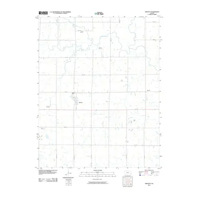
2010 Map of Bartlett
USGS Topo · Published 2010About this map
Bartlett sits at the heart of this rural Labette County landscape, where a grid of section roads like Rooks Rd and Victory Rd divides the prairie. This area is defined by its deep-rooted local history, preserved in numerous family and community burial grounds including Phillips Cemetery, Hackberry Cemetery, and Cecil Cemetery. The hydrology of the region is equally central, with Hackberry Creek and Lake Creek meandering across the terrain. Near the town center, Bartlett Dam controls the local flow, while the prominent rise of Big Hill stands out in the eastern portion of the survey. The presence of Town Creek and Labette Creek further illustrates the complex drainage patterns that shaped early settlement and agriculture in this corner of Kansas.
Find a feature on this map
29 named features on this map. Tap any name to fly to it.
Don’t see what you’re looking for? This feature index may not catch every label — zoom into the map to look around manually.
Map Details
Editions of this 2010 Bartlett Map
This is the sole edition of this map. No revisions or reprints were ever made.
Other maps of this area

1886 · Parsons
USGS Topo · 1:125,000

1893 · Parsons
USGS Topo · 1:125,000

1901 · Vinita
USGS Topo · 1:125,000

1913 · Vinita
USGS Topo · 1:125,000

1944 · Oswego
USGS Topo · 1:62,500

1946 · Oswego
USGS Topo · 1:48,000

1946 · Mound Valley
USGS Topo · 1:62,500

1947 · Joplin
USGS Topo · 1:250,000
1948 · Oswego
USGS Topo · 1:62,500
1948 · Mound Valley
USGS Topo · 1:62,500