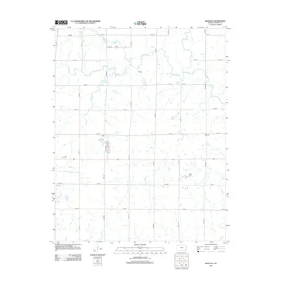
2012 Map of Bartlett
USGS Topo · Published 2012About this map
The agricultural landscape of southeastern Kansas is meticulously detailed in this 2012 survey. Centered on the town of Bartlett, the grid of section roads like Rooks Rd and Scott Rd defines the prairie layout, while several family and community burial grounds, including Phillips Cem, Hackberry Cem, and Cecil Cem, provide essential anchor points for local genealogical research. The drainage patterns of Labette Cr and its tributaries, such as Hackberry Cr and Turkey Cr, meander through the landscape, influencing the placement of early homesteads and field boundaries. The small settlement of Big Hill appears in the eastern portion of the quadrangle, connected by a network of rural routes that have served the region's farming economy for generations. This map captures the intersection of natural watercourses like Town Cr with the rigid township and range system that organized this part of Labette County.
Find a feature on this map
38 named features on this map. Tap any name to fly to it.
Don’t see what you’re looking for? This feature index may not catch every label — zoom into the map to look around manually.
Map Details
Editions of this 2012 Bartlett Map
This is the sole edition of this map. No revisions or reprints were ever made.
Other maps of this area

1886 · Parsons
USGS Topo · 1:125,000

1893 · Parsons
USGS Topo · 1:125,000

1901 · Vinita
USGS Topo · 1:125,000

1913 · Vinita
USGS Topo · 1:125,000

1944 · Oswego
USGS Topo · 1:62,500

1946 · Oswego
USGS Topo · 1:48,000

1946 · Mound Valley
USGS Topo · 1:62,500

1947 · Joplin
USGS Topo · 1:250,000
1948 · Oswego
USGS Topo · 1:62,500
1948 · Mound Valley
USGS Topo · 1:62,500