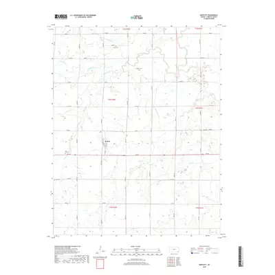
2018 Map of Bartlett
USGS Topo · Published 2018About this map
Bartlett sits at the center of this section of Labette County, organized around the intersection of 4000 RD and Rooks RD. The village layout is defined by streets such as Hackberry St, Main St, and Walnut St, representing a classic Midwestern rural settlement pattern. The surrounding landscape is a drainage network for several water bodies, including Deer Creek, Hackberry Creek, and Labette Creek, which carve gentle paths through the agricultural sections.
Find a feature on this map
41 named features on this map. Tap any name to fly to it.
Don’t see what you’re looking for? This feature index may not catch every label — zoom into the map to look around manually.
Map Details
Editions of this 2018 Bartlett Map
This is the sole edition of this map. No revisions or reprints were ever made.
Other maps of this area

1886 · Parsons
USGS Topo · 1:125,000

1893 · Parsons
USGS Topo · 1:125,000

1901 · Vinita
USGS Topo · 1:125,000

1913 · Vinita
USGS Topo · 1:125,000

1944 · Oswego
USGS Topo · 1:62,500

1946 · Oswego
USGS Topo · 1:48,000

1946 · Mound Valley
USGS Topo · 1:62,500

1947 · Joplin
USGS Topo · 1:250,000
1948 · Oswego
USGS Topo · 1:62,500
1948 · Mound Valley
USGS Topo · 1:62,500