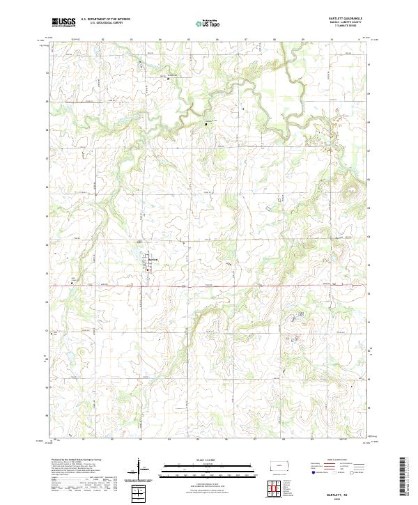
2022 Map of Bartlett
USGS Topo · Published 2022About this map
Bartlett stands at the center of this Labette County landscape, a small community organized along a strict grid featuring Walnut St and Hackberry St. The surrounding countryside is defined by the Section-Township-Range system, with a network of section-line roads like Queens Rd and Scott Rd connecting isolated farmsteads and rural landmarks. The drainage patterns of Hackberry Creek and Labette Creek break the geometric regularity of the fields, creating winding corridors of vegetation that cut across the agricultural plots.
Find a feature on this map
40 named features on this map. Tap any name to fly to it.
Don’t see what you’re looking for? This feature index may not catch every label — zoom into the map to look around manually.
Map Details
Editions of this 2022 Bartlett Map
This is the sole edition of this map. No revisions or reprints were ever made.
Other maps of this area

1886 · Parsons
USGS Topo · 1:125,000

1893 · Parsons
USGS Topo · 1:125,000

1901 · Vinita
USGS Topo · 1:125,000

1913 · Vinita
USGS Topo · 1:125,000

1944 · Oswego
USGS Topo · 1:62,500

1946 · Oswego
USGS Topo · 1:48,000

1946 · Mound Valley
USGS Topo · 1:62,500

1947 · Joplin
USGS Topo · 1:250,000
1948 · Oswego
USGS Topo · 1:62,500
1948 · Mound Valley
USGS Topo · 1:62,500