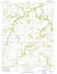
1974 Map of Bartlett
USGS Topo · Published 1975About this map
Bartlett stands as the primary hub of this 1970s landscape, positioned along the Missouri Pacific rail line and surrounded by the winding courses of Hackberry Creek and Turkey Creek. The map documents a rural transition zone where the Old Indian Treaty Boundary cuts across the southern portion of the quadrangle, just north of the border between Kansas and Oklahoma. This historical line separates early tribal lands from the surrounding townships, marking a significant frontier-era demarcation still recognized in the mid-20th century survey.
Find a feature on this map
25 named features on this map. Tap any name to fly to it.
Don’t see what you’re looking for? This feature index may not catch every label — zoom into the map to look around manually.
Map Details
Editions of this 1974 Bartlett Map
This is the sole edition of this map. No revisions or reprints were ever made.
Other maps of this area

1886 · Parsons
USGS Topo · 1:125,000

1893 · Parsons
USGS Topo · 1:125,000

1901 · Vinita
USGS Topo · 1:125,000

1913 · Vinita
USGS Topo · 1:125,000

1944 · Oswego
USGS Topo · 1:62,500

1946 · Oswego
USGS Topo · 1:48,000

1946 · Mound Valley
USGS Topo · 1:62,500

1947 · Joplin
USGS Topo · 1:250,000
1948 · Oswego
USGS Topo · 1:62,500
1948 · Mound Valley
USGS Topo · 1:62,500