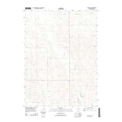
2014 Map of Bartlett SE
USGS Topo · Published 2014About this map
Clear Cr meanders through this portion of Wheeler County, defining the drainage patterns of a landscape marked by sandy elevations and isolated water features. In the southeastern corner, Pibel Lake serves as a local landmark, accompanied by the nearby Pibel Cem. The area is bisected by a grid of rural routes, including the prominent north-south corridor of Welch Ave and the east-west passage of Ne-91. Historical road alignments are preserved here, such as Old Highway 101, which cuts across the northern section of the quadrangle. The map reflects a sparsely populated agricultural region where the placement of cemeteries and local roads like Ericson Lake Rd provides critical geographic context for family historians tracing roots in this part of Nebraska.
Find a feature on this map
21 named features on this map. Tap any name to fly to it.
Don’t see what you’re looking for? This feature index may not catch every label — zoom into the map to look around manually.
Map Details
Editions of this 2014 Bartlett SE Map
This is the sole edition of this map. No revisions or reprints were ever made.
Other maps of this area

1954 · Greeley NE
USGS Topo · 1:24,000

1954 · Greeley NW
USGS Topo · 1:24,000

1954 · Bartlett NW
USGS Topo · 1:24,000

1954 · Spalding NW
USGS Topo · 1:24,000

1954 · Bartlett SE
USGS Topo · 1:24,000

1954 · Bartlett
USGS Topo · 1:24,000

1954 · Ericson
USGS Topo · 1:24,000

1955 · Broken Bow
USGS Topo · 1:250,000

1956 · Broken Bow
USGS Topo · 1:250,000

1960 · Spalding 2 SW
USGS Topo · 1:24,000