
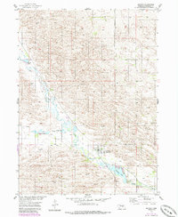
1954 Map of Ericson
USGS Topo · Published 1956About this map
The Cedar River valley in the Sandhills of Wheeler County serves as the central artery for this 1950s survey, dictating the settlement patterns and agricultural infrastructure of the region. The village of Ericson is the primary hub, situated near the riverbanks where water management is evident through the presence of an early Powerplant and the creation of Ericson Lake. The surrounding terrain is defined by a complex network of wetlands and small water bodies, including Psotas Lake, Kruml Lake, and Hovart Lakes, which dot the landscape alongside Cedar Creek and Dry Cedar Creek.
Find a feature on this map
14 named features on this map. Tap any name to fly to it.
Don’t see what you’re looking for? This feature index may not catch every label — zoom into the map to look around manually.
Map Details
Editions of this 1954 Ericson Map
2 editions found
Other maps of this area

1954 · Gables SE
USGS Topo · 1:24,000

1954 · Ord NE
USGS Topo · 1:24,000

1954 · Greeley NE
USGS Topo · 1:24,000

1954 · Greeley NW
USGS Topo · 1:24,000

1954 · Bartlett NW
USGS Topo · 1:24,000

1954 · Bartlett SE
USGS Topo · 1:24,000

1954 · Bartlett
USGS Topo · 1:24,000

1954 · Gables
USGS Topo · 1:24,000

1955 · Broken Bow
USGS Topo · 1:250,000

1956 · Broken Bow
USGS Topo · 1:250,000