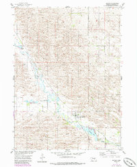
1954 Map of Ericson
USGS Topo · Published 1986About this map
The Cedar River valley in Wheeler County dominates this mid-century landscape, centered on the village of Ericson. The settlement's infrastructure is intimately tied to the water, featuring a local Powerplant situated just below Ericson Lake. This map represents a period of resource management in the Sandhills region, mapped as part of the Department of the Interior's efforts for the development of the Missouri River Basin.
Find a feature on this map
12 named features on this map. Tap any name to fly to it.
Don’t see what you’re looking for? This feature index may not catch every label — zoom into the map to look around manually.
Map Details
Editions of this 1954 Ericson Map
2 editions found
Other maps of this area

1954 · Gables SE
USGS Topo · 1:24,000

1954 · Ord NE
USGS Topo · 1:24,000

1954 · Greeley NE
USGS Topo · 1:24,000

1954 · Greeley NW
USGS Topo · 1:24,000

1954 · Bartlett NW
USGS Topo · 1:24,000

1954 · Bartlett SE
USGS Topo · 1:24,000

1954 · Bartlett
USGS Topo · 1:24,000

1954 · Ericson
USGS Topo · 1:24,000

1954 · Gables
USGS Topo · 1:24,000

1955 · Broken Bow
USGS Topo · 1:250,000