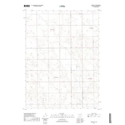
2017 Map of Bartlett SE
USGS Topo · Published 2017About this map
Clear Cr meanders through the central terrain of Wheeler County in this 2017 study, where the landscape is defined by the section lines and rural routes of the Sandhills region. The southeastern portion of the map is anchored by the community assets near Pibel Lake, including the Pibel Cem and the surrounding recreational infrastructure. A network of secondary roads, such as Ott Rd and 830 Rd, grid the territory, providing access to the expansive agricultural and ranching tracts. The presence of Old State Hwy 101 along the eastern boundary and routes like Ericson Lake Rd and Pibel Lake Rd in the south illustrates the local transit patterns connecting these rural homesteads and natural water features. This map captures the modern distribution of land use and local landmarks in a region characterized by its quiet watercourses and established rural cemeteries.
Find a feature on this map
16 named features on this map. Tap any name to fly to it.
Don’t see what you’re looking for? This feature index may not catch every label — zoom into the map to look around manually.
Map Details
Editions of this 2017 Bartlett SE Map
This is the sole edition of this map. No revisions or reprints were ever made.
Other maps of this area

1954 · Greeley NE
USGS Topo · 1:24,000

1954 · Greeley NW
USGS Topo · 1:24,000

1954 · Bartlett NW
USGS Topo · 1:24,000

1954 · Spalding NW
USGS Topo · 1:24,000

1954 · Bartlett SE
USGS Topo · 1:24,000

1954 · Bartlett
USGS Topo · 1:24,000

1954 · Ericson
USGS Topo · 1:24,000

1955 · Broken Bow
USGS Topo · 1:250,000

1956 · Broken Bow
USGS Topo · 1:250,000

1960 · Spalding 2 SW
USGS Topo · 1:24,000