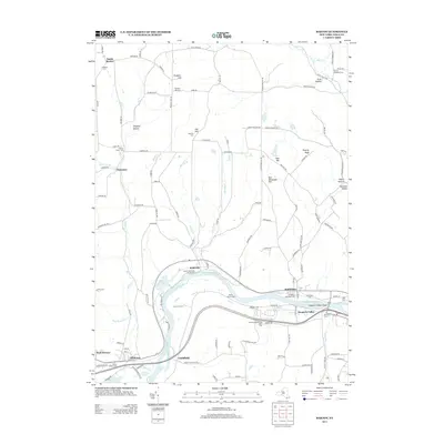
2013 Map of Barton
USGS Topo · Published 2013About this map
The Susquehanna River defines the southern reach of this Tioga County landscape, winding past the village of Barton and the community of Smithboro. The river valley acts as a corridor for settlement and transit, while the northern terrain rises into distinct high points like Prospect Hill, Oak Hill, and Poverty Knob. This 2013 survey illustrates a rural landscape where many family-named cemeteries and small churches remain central to the geography. Genealogists will find a concentration of burial grounds including N Barton Cem, Prospect Hill Cem, and the Smithboro Cem. The map captures the interface between modern infrastructure, such as the Nichols Southbound Rest Area, and the enduring natural features of the river basin like Hoopers Valley Island and various tributaries including Ellis Cr and Pipe Cr.
Find a feature on this map
128 named features on this map. Tap any name to fly to it.
Don’t see what you’re looking for? This feature index may not catch every label — zoom into the map to look around manually.
Map Details
Editions of this 2013 Barton Map
This is the sole edition of this map. No revisions or reprints were ever made.
Other maps of this area

1902 · Waverly
USGS Topo · 1:62,500

1903 · Owego
USGS Topo · 1:62,500

1905 · Watkins Glen
USGS Topo · 1:125,000

1906 · Catatonk
USGS Topo · 1:125,000

1923 · Towanda
USGS Topo · 1:62,500

1926 · Towanda
USGS Topo · 1:62,500

1939 · Sayre
USGS Topo · 1:62,500

1942 · Sayre
USGS Topo · 1:62,500

1943 · Towanda
USGS Topo · 1:62,500

1948 · Sayre
USGS Topo · 1:62,500