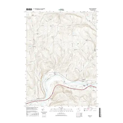
2016 Map of Barton
USGS Topo · Published 2016About this map
The Susquehanna River carves a deep valley through the southern half of this landscape, defining the development of communities like Barton and Smithboro. Settlement patterns follow the river's bend and the paths of tributaries such as Pipe Creek and Ellis Brook. The uplands are marked by numerous family and community landmarks, including Prospect Hill and Poverty Knob, alongside a dense concentration of historical burial grounds such as the North Barton Cem and Oak Hill Cem.
Find a feature on this map
103 named features on this map. Tap any name to fly to it.
Don’t see what you’re looking for? This feature index may not catch every label — zoom into the map to look around manually.
Map Details
Editions of this 2016 Barton Map
This is the sole edition of this map. No revisions or reprints were ever made.
Other maps of this area

1902 · Waverly
USGS Topo · 1:62,500

1903 · Owego
USGS Topo · 1:62,500

1905 · Watkins Glen
USGS Topo · 1:125,000

1906 · Catatonk
USGS Topo · 1:125,000

1923 · Towanda
USGS Topo · 1:62,500

1926 · Towanda
USGS Topo · 1:62,500

1939 · Sayre
USGS Topo · 1:62,500

1942 · Sayre
USGS Topo · 1:62,500

1943 · Towanda
USGS Topo · 1:62,500

1948 · Sayre
USGS Topo · 1:62,500