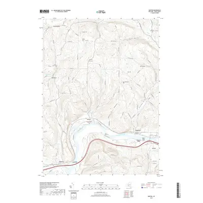
2019 Map of Barton
USGS Topo · Published 2019About this map
The Susquehanna River defines the southern reach of this Tioga County landscape, where the settlements of Barton, Smithboro, and Nichols sit near the river's edge. The terrain is marked by steep ridges and valleys, including Diamond Valley, Frost Hollow, and notable heights like Prospect Hill and Ross Hill. The distribution of historical burial sites throughout these uplands and riverside plains offers a clear view of the area's development, with sites such as North Barton Cem and Beaver Meadows Cem serving as key genealogical anchors.
Find a feature on this map
111 named features on this map. Tap any name to fly to it.
Don’t see what you’re looking for? This feature index may not catch every label — zoom into the map to look around manually.
Map Details
Editions of this 2019 Barton Map
This is the sole edition of this map. No revisions or reprints were ever made.
Other maps of this area

1902 · Waverly
USGS Topo · 1:62,500

1903 · Owego
USGS Topo · 1:62,500

1905 · Watkins Glen
USGS Topo · 1:125,000

1906 · Catatonk
USGS Topo · 1:125,000

1923 · Towanda
USGS Topo · 1:62,500

1926 · Towanda
USGS Topo · 1:62,500

1939 · Sayre
USGS Topo · 1:62,500

1942 · Sayre
USGS Topo · 1:62,500

1943 · Towanda
USGS Topo · 1:62,500

1948 · Sayre
USGS Topo · 1:62,500