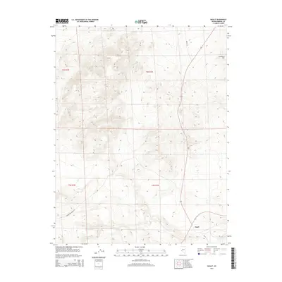
2014 Map of Basalt
USGS Topo · Published 2014About this map
Basalt marks the southeastern corner of this high-desert landscape in Mineral County, positioned along a transportation corridor that skirts the eastern edge of the Candelaria Hills. The map details a transition from the lower valley floor near the settlement to the rising elevations of the mountain range to the north. Extensive topographic work by the U.S. Geological Survey reveals a complex network of canyons and ridges, accessible by routes such as Marietta Rd and the Truman Mdw Ranch O-019. This 2014 survey documents the modern state of these rural lands, which remain characterized by vast open stretches of public land defined by the township and range survey lines of the t2n r33e and t3n r33e districts.
Find a feature on this map
8 named features on this map. Tap any name to fly to it.
Don’t see what you’re looking for? This feature index may not catch every label — zoom into the map to look around manually.
Map Details
Editions of this 2014 Basalt Map
This is the sole edition of this map. No revisions or reprints were ever made.
Other maps of this area

1909 · Hawthorne
USGS Topo · 1:250,000

1911 · Hawthorne
USGS Topo · 1:250,000

1915 · Hawthorne
USGS Topo · 1:250,000

1917 · White Mountain
USGS Topo · 1:125,000

1947 · Mariposa
USGS Topo · 1:250,000

1948 · Walker Lake
USGS Topo · 1:250,000

1948 · Mariposa
USGS Topo · 1:250,000

1957 · Walker Lake
USGS Topo · 1:250,000

1957 · Mariposa
USGS Topo · 1:250,000

1962 · Walker Lake
USGS Topo · 1:250,000