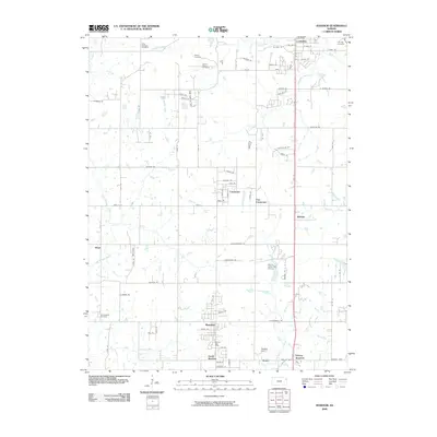
2009 Map of Basehor
USGS Topo · Published 2009About this map
Basehor and South Basehor anchor the southern portion of this landscape, where suburban expansion meets a network of long-established rural landmarks. The area is defined by its numerous small creeks, including Ninemile Creek, Wolf Creek, and Little Stranger Creek, which snake through a grid of country roads and newer developments. Genealogists will find significant value in the concentration of local burial grounds, such as the Little Stranger Cemetery, Starns Family Cemetery, and Holy Angels Cemetery, reflecting the multi-generational history of the township. In the north, the outskirts of Lansing show a dense residential pattern transitioning into the agricultural outskirts near Fairmount and East Fairmount. Unique markers of early 21st-century land use appear throughout, from the High Crest Air Park and Falcon Lakes Golf Course to the distinct crossroads of Victory Junction and Stone.
Find a feature on this map
62 named features on this map. Tap any name to fly to it.
Don’t see what you’re looking for? This feature index may not catch every label — zoom into the map to look around manually.
Map Details
Editions of this 2009 Basehor Map
This is the sole edition of this map. No revisions or reprints were ever made.
Other maps of this area

1886 · Oskaloosa
USGS Topo · 1:125,000

1888 · Oskaloosa
USGS Topo · 1:125,000

1890 · Kansas City
USGS Topo · 1:125,000

1894 · Kansas City
USGS Topo · 1:125,000

1894 · Oskaloosa
USGS Topo · 1:125,000

1910 · Leavenworth
USGS Topo · 1:62,500

1934 · Bonner Springs
USGS Topo · 1:48,000

1934 · Edwardsville
USGS Topo · 1:24,000

1934 · Wolcott
USGS Topo · 1:24,000

1940 · Bonner Springs
USGS Topo · 1:62,500