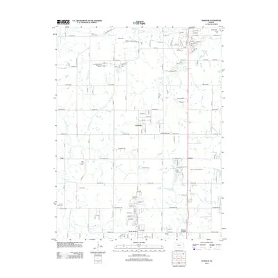
2012 Map of Basehor
USGS Topo · Published 2012About this map
Starns Cem and the Starns Family Cem occupy the northern hills above the drainage of Sevenmile Cr, marking the longstanding legacy of local families in this part of Leavenworth County. The landscape is defined by its transition from traditional agricultural plots to modern recreational and residential developments, as seen at the Falcon Lakes Golf Course near Wallula. Several small historic settlements and rural junctions, including Fairmount, Stone, and Victory Junction, are connected by a network of established roads like Stranger Rd and New Lawrence Dr. Aviation and infrastructure are notable features of this period, with both Highcrest Air Park and Neu Field Airport serving the area alongside the sprawling Bonner Springs Interchange. The map also captures several family-named burial grounds, such as Little Stranger Cem and Holy Angels Cem, which are essential touchpoints for local genealogical research.
Find a feature on this map
83 named features on this map. Tap any name to fly to it.
Don’t see what you’re looking for? This feature index may not catch every label — zoom into the map to look around manually.
Map Details
Editions of this 2012 Basehor Map
This is the sole edition of this map. No revisions or reprints were ever made.
Other maps of this area

1886 · Oskaloosa
USGS Topo · 1:125,000

1888 · Oskaloosa
USGS Topo · 1:125,000

1890 · Kansas City
USGS Topo · 1:125,000

1894 · Kansas City
USGS Topo · 1:125,000

1894 · Oskaloosa
USGS Topo · 1:125,000

1910 · Leavenworth
USGS Topo · 1:62,500

1934 · Bonner Springs
USGS Topo · 1:48,000

1934 · Edwardsville
USGS Topo · 1:24,000

1934 · Wolcott
USGS Topo · 1:24,000

1940 · Bonner Springs
USGS Topo · 1:62,500