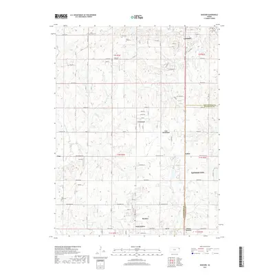
2018 Map of Basehor
USGS Topo · Published 2018About this map
The boundary between Leavenworth Co and Wyandotte Co bisects this Kansas landscape, where the growing residential footprints of Basehor and Lansing meet the rural expanses of the Missouri River valley periphery. For genealogists, the map is particularly rich in burial sites, documenting Little Stranger Cem, Starns Family Cem, and Holy Angels Cem. The terrain is defined by the drainage of Little Stranger Cr and Ninemile Cr, which cut through a network of section-line roads like McIntyre Rd and Hollingsworth Rd. Small communities and named junctions such as Fairmount, Wallula, and Victory Junction mark the transition from the city's western edge toward the agricultural interior, while Highcrest Air Park indicates the modern utility of the upland plains.
Find a feature on this map
91 named features on this map. Tap any name to fly to it.
Don’t see what you’re looking for? This feature index may not catch every label — zoom into the map to look around manually.
Map Details
Editions of this 2018 Basehor Map
This is the sole edition of this map. No revisions or reprints were ever made.
Other maps of this area

1886 · Oskaloosa
USGS Topo · 1:125,000

1888 · Oskaloosa
USGS Topo · 1:125,000

1890 · Kansas City
USGS Topo · 1:125,000

1894 · Kansas City
USGS Topo · 1:125,000

1894 · Oskaloosa
USGS Topo · 1:125,000

1910 · Leavenworth
USGS Topo · 1:62,500

1934 · Bonner Springs
USGS Topo · 1:48,000

1934 · Edwardsville
USGS Topo · 1:24,000

1934 · Wolcott
USGS Topo · 1:24,000

1940 · Bonner Springs
USGS Topo · 1:62,500