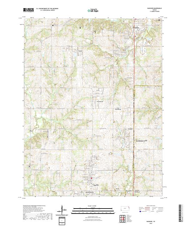
2022 Map of Basehor
USGS Topo · Published 2022About this map
Lansing and Basehor anchor this 2022 survey of the Leavenworth and Wyandotte County border, a landscape shaped by creek drainages and a growing network of residential developments. The area between the northern city of Lansing and the southern cluster of Basehor, South Basehor, and Victory Junction is marked by agricultural roots and historical markers, including several rural burial grounds like Starns Cem and Little Stranger Cem. The terrain is defined by the winding paths of Ninemile Cr, Little Stranger Cr, and Wolf Creek, which cut through the undulating hills between small settlements such as Fairmount, East Fairmount, and Wallula. Private aviation history is noted at Highcrest Air Park, while the southern reaches show the modern sprawl of Kansas City encroaching into the historically rural townships of Leavenworth County.
Find a feature on this map
84 named features on this map. Tap any name to fly to it.
Don’t see what you’re looking for? This feature index may not catch every label — zoom into the map to look around manually.
Map Details
Editions of this 2022 Basehor Map
This is the sole edition of this map. No revisions or reprints were ever made.
Historical Maps of Kansas City Through Time
4 maps found