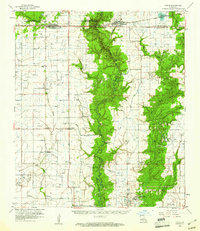
1960 Map of Basile
USGS Topo · Published 1961About this map
Basile and the surrounding prairies of south-central Louisiana are defined here by a dense network of rice-farming infrastructure and petroleum exploration. The map captures an era of intensive land use, where the Missouri Pacific and Southern Pacific railroads provided the vital transport links for small agricultural communities like Elton, Iota, and Hathaway. The landscape is etched with irrigation siphons and flumes, including the prominent Missouri Flume, supporting the water-intensive demands of local rice cultivation.
Find a feature on this map
42 named features on this map. Tap any name to fly to it.
Don’t see what you’re looking for? This feature index may not catch every label — zoom into the map to look around manually.
Map Details
Editions of this 1960 Basile Map
4 editions found
Other maps of this area

1946 · Mermentau
USGS Topo · 1:31,680

1946 · Jennings
USGS Topo · 1:31,680

1947 · Evangeline
USGS Topo · 1:31,680

1947 · Kinder
USGS Topo · 1:31,680

1947 · Fruge Lake
USGS Topo · 1:31,680

1947 · Oberlin
USGS Topo · 1:31,680

1947 · Pine Island
USGS Topo · 1:31,680

1947 · Welsh
USGS Topo · 1:31,680

1947 · Redland
USGS Topo · 1:31,680

1947 · Elton
USGS Topo · 1:31,680