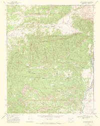
1968 Map of Basin Mountain
USGS Topo · Published 1972About this map
Basin Mountain and the high ridges of La Plata County define this landscape, where the southern reaches of the San Juan Mountains meet the Animas River valley. The map documents a rugged terrain dominated by deeply incised drainages like Black Water Canyon, Cottonwood Canyon, and Sawmill Canyon. Settlement is sparse, concentrated near the small community of La Posta in the southeast, where the river serves as the primary corridor for movement and water management.
Find a feature on this map
40 named features on this map. Tap any name to fly to it.
Don’t see what you’re looking for? This feature index may not catch every label — zoom into the map to look around manually.
Map Details
Editions of this 1968 Basin Mountain Map
2 editions found
Other maps of this area

1895 · La Plata
USGS Topo · 1:62,500

1897 · La Plata
USGS Topo · 1:62,500

1898 · Durango
USGS Topo · 1:62,500

1899 · La Plata
USGS Topo · 1:62,500

1907 · Durango
USGS Topo · 1:62,500

1908 · Ignacio
USGS Topo · 1:125,000

1908 · Durango
USGS Topo · 1:62,500

1908 · La Plata
USGS Topo · 1:62,500

1913 · Red Mesa
USGS Topo · 1:62,500

1924 · Ignacio
USGS Topo · 1:125,000