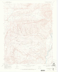
1968 Map of Basin Mountain
USGS Topo · Published 1972About this map
The Southern Ute Indian Reservation Boundary cuts across this high-desert landscape in La Plata County, marking a significant cultural and political border in the late 1960s. The eastern edge of the map is defined by the winding course of the Animas River, where water management and transportation infrastructure meet at the Weaselskin Bridge and along the Sunnyside Ditch. The small settlement of La Posta sits near the river's bank, serving as a focal point for the surrounding canyon country.
Find a feature on this map
37 named features on this map. Tap any name to fly to it.
Don’t see what you’re looking for? This feature index may not catch every label — zoom into the map to look around manually.
Map Details
Editions of this 1968 Basin Mountain Map
2 editions found
Other maps of this area

1895 · La Plata
USGS Topo · 1:62,500

1897 · La Plata
USGS Topo · 1:62,500

1898 · Durango
USGS Topo · 1:62,500

1899 · La Plata
USGS Topo · 1:62,500

1907 · Durango
USGS Topo · 1:62,500

1908 · Ignacio
USGS Topo · 1:125,000

1908 · Durango
USGS Topo · 1:62,500

1908 · La Plata
USGS Topo · 1:62,500

1913 · Red Mesa
USGS Topo · 1:62,500

1924 · Ignacio
USGS Topo · 1:125,000