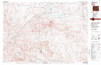
1982 Map of Basin
USGS Topo · Published 1983About this map
The Bighorn River corridor serves as the primary artery for settlement and industry in this 1982 survey of north-central Wyoming. The regional economy is anchored by the Burlington Northern railroad, which links the towns of Basin and Greybull. Agriculture and resource extraction define the landscape, with irrigation canals and ditches fanning out across the Emblem Bench to support farming near Burlington and Otto. In the higher elevations to the west, coal and mineral history is evidenced by the Eagle Mine, Wiley Mine, and Black Diamond Mine.
Find a feature on this map
39 named features on this map. Tap any name to fly to it.
Don’t see what you’re looking for? This feature index may not catch every label — zoom into the map to look around manually.
Map Details
Editions of this 1982 Basin Map
This is the sole edition of this map. No revisions or reprints were ever made.
Other maps of this area

1898 · Bald Mountain
USGS Topo · 1:125,000

1901 · Bald Mountain
USGS Topo · 1:125,000

1904 · Kirwin
USGS Topo · 1:125,000

1906 · Kirwin
USGS Topo · 1:125,000

1911 · Meeteetse
USGS Topo · 1:62,500

1911 · Oregon Basin
USGS Topo · 1:62,500

1913 · Oregon Basin
USGS Topo · 1:62,500

1913 · Meeteetse
USGS Topo · 1:62,500

1913 · Grass Creek Basin
USGS Topo · 1:62,500

1914 · Blue Mesa
USGS Topo · 1:62,500