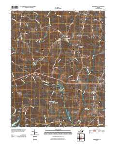
2010 Map of Baskerville
USGS Topo · Published 2010About this map
Baskerville and its surrounding crossroads communities define this part of Mecklenburg County, where a network of rural routes like Baskerville Rd and Hayes Mill Rd connect family-named landmarks and long-standing local institutions. The presence of State Prison Camp Number 4 near Stony Cross provides a unique architectural and social anchor to the landscape, while the numerous burial grounds, including Ebenezer Cemetery and Saint Andrews Cemetery, offer vital touchpoints for genealogical research. The terrain is intricately carved by waterways such as Allen Creek, Cox Creek, and Mines Creek, which feed into local reservoirs like Johnsons-Pond. Small settlements such as Antlers, Norvello, and Gills are situated along the primary roads, illustrating a settlement pattern of dispersed farmsteads and rural junctions typical of the Southside Virginia region.
Find a feature on this map
66 named features on this map. Tap any name to fly to it.
Don’t see what you’re looking for? This feature index may not catch every label — zoom into the map to look around manually.
Map Details
Editions of this 2010 Baskerville Map
This is the sole edition of this map. No revisions or reprints were ever made.
Other maps of this area

1953 · Greensboro
USGS Topo · 1:250,000

1954 · Greensboro
USGS Topo · 1:250,000

1955 · Chase City
USGS Topo · 1:62,500

1955 · Kenbridge
USGS Topo · 1:62,500

1955 · Boydton
USGS Topo · 1:62,500

1962 · Greensboro
USGS Topo · 1:250,000

1966 · Greensboro
USGS Topo · 1:250,000
1966 · Wightman
USGS Topo · 1:24,000
1966 · North View
USGS Topo · 1:24,000
1966 · Chase City
USGS Topo · 1:24,000