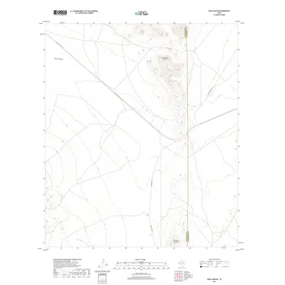
2019 Map of Bass Canyon
USGS Topo · Published 2019About this map
The high desert terrain of the Carrizo Mountains and the northern reach of the Van Horn Mountains dominate this West Texas landscape along the Hudspeth and Culberson County line. This region is defined by its drainage patterns and transport corridors, with the broad Eagle Flat Draw and the seasonal path of the Green River carving through the arid geography. The Southern Pacific Rd cuts a straight diagonal across the desert floor, marking a vital transit route that has historically linked this remote section of the Trans-Pecos to broader networks. Local access is maintained via unpaved tracks like Green River Rd and Scott Crossing Rd, which provide passage through the foothills and into the mouth of Bass Canyon. This map provides a clear record of the topography and infrastructure in a sparsely populated ranching and rail corridor in the 21st century.
Find a feature on this map
9 named features on this map. Tap any name to fly to it.
Don’t see what you’re looking for? This feature index may not catch every label — zoom into the map to look around manually.
Map Details
Editions of this 2019 Bass Canyon Map
This is the sole edition of this map. No revisions or reprints were ever made.
Other maps of this area

1892 · Chispa
USGS Topo · 1:125,000

1895 · Chispa
USGS Topo · 1:125,000

1895 · Sierra Blanca
USGS Topo · 1:125,000

1897 · Eagle Mountain
USGS Topo · 1:125,000

1897 · Chispa
USGS Topo · 1:125,000

1906 · Van Horn
USGS Topo · 1:125,000

1916 · Eagle Mountain
USGS Topo · 1:125,000

1954 · Van Horn
USGS Topo · 1:250,000

1958 · Van Horn
USGS Topo · 1:250,000

1959 · Marfa
USGS Topo · 1:250,000