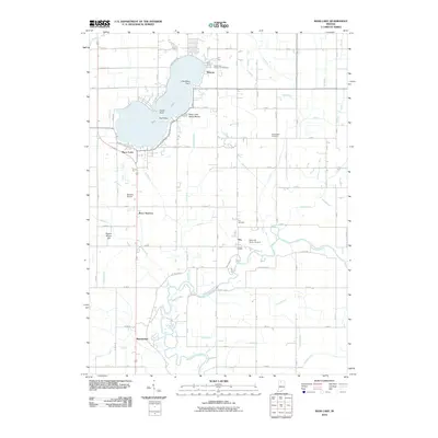
2010 Map of Bass Lake
USGS Topo · Published 2010About this map
Bass Lake dominates this Northern Indiana landscape, its waters framed by the small settlements of Winona, Bass Station, and the Bass Lake State Beach. The lake's irregular shoreline is defined by named points such as Cedar Point and Gull Point, while the surrounding flatlands are etched with an intricate network of drainage systems like Castleman Ditch and James Ditch. These man-made channels tell the story of a region converted from wetlands into productive agricultural territory.
Find a feature on this map
70 named features on this map. Tap any name to fly to it.
Don’t see what you’re looking for? This feature index may not catch every label — zoom into the map to look around manually.
Map Details
Editions of this 2010 Bass Lake Map
This is the sole edition of this map. No revisions or reprints were ever made.
Other maps of this area

1953 · Chicago
USGS Topo · 1:250,000

1957 · Chicago
USGS Topo · 1:250,000

1957 · Knox East
USGS Topo · 1:24,000

1957 · Knox West
USGS Topo · 1:24,000

1958 · Donaldson
USGS Topo · 1:24,000

1962 · Winamac
USGS Topo · 1:24,000

1962 · Kewanna
USGS Topo · 1:24,000

1962 · Denham
USGS Topo · 1:24,000
1962 · Ripley
USGS Topo · 1:24,000

1962 · Bass Lake
USGS Topo · 1:24,000