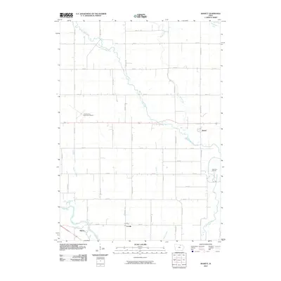
2010 Map of Bassett
USGS Topo · Published 2010About this map
Little Cedar River winds south through this corner of Chickasaw County, defining a landscape of agricultural sections and river-bottom timber. The small settlement of Bassett sits near the eastern edge, while the hamlets of Carrville and Midway occupy the southwest corner near the confluence of local drainage with the larger Cedar River. This survey captures the rural layout of the region in the early 21st century, showing how the original land survey grid persists through modern roads like Victory Ave and Beaumont Ave. Notable local landmarks include the Charles City Municipal Airport in the west and the Cedar View Cemetery to the east. Several smaller waterways, including Beaver Creek, Schultz Creek, and Gizzard Creek, feed into the primary river systems, creating a network of drainage that has long dictated the placement of homesteads and infrastructure in this part of Iowa.
Find a feature on this map
34 named features on this map. Tap any name to fly to it.
Don’t see what you’re looking for? This feature index may not catch every label — zoom into the map to look around manually.
Map Details
Editions of this 2010 Bassett Map
This is the sole edition of this map. No revisions or reprints were ever made.
Other maps of this area

1954 · Mason City
USGS Topo · 1:250,000

1954 · Waterloo
USGS Topo · 1:250,000

1955 · Waterloo
USGS Topo · 1:250,000

1957 · Mason City
USGS Topo · 1:250,000

1958 · Mason City
USGS Topo · 1:250,000

1971 · Tripoli NW
USGS Topo · 1:24,000

1971 · Charles City
USGS Topo · 1:24,000

1971 · Nashua NW
USGS Topo · 1:24,000

1971 · Bassett
USGS Topo · 1:24,000

1971 · Colwell
USGS Topo · 1:24,000