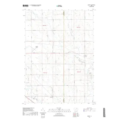
2018 Map of Bassett
USGS Topo · Published 2018About this map
Bassett and Carrville anchor this agricultural landscape along the winding course of the Little Cedar River. The terrain is defined by the drainage patterns of several tributaries, including Beaver Cr and Schultz Cr, which carve through the Iowa plains. The confluence of the Little Cedar River and the main Cedar River in the southwestern corner highlights the importance of these waterways to the regional geography. Transportation is centered on a grid of rural roads and highways, including Co HWY b59 and Co HWY b57, facilitating movement between small centers like Midway. The presence of the Northeast Iowa Regional Airport north of Gizzard Cr indicates a modern layer of infrastructure laid over a traditional farming foundation, while the Cedar View Cem on the eastern edge provides a localized point of genealogical interest for Chickasaw County families.
Find a feature on this map
47 named features on this map. Tap any name to fly to it.
Don’t see what you’re looking for? This feature index may not catch every label — zoom into the map to look around manually.
Map Details
Editions of this 2018 Bassett Map
This is the sole edition of this map. No revisions or reprints were ever made.
Other maps of this area

1954 · Mason City
USGS Topo · 1:250,000

1954 · Waterloo
USGS Topo · 1:250,000

1955 · Waterloo
USGS Topo · 1:250,000

1957 · Mason City
USGS Topo · 1:250,000

1958 · Mason City
USGS Topo · 1:250,000

1971 · Tripoli NW
USGS Topo · 1:24,000

1971 · Charles City
USGS Topo · 1:24,000

1971 · Nashua NW
USGS Topo · 1:24,000

1971 · Bassett
USGS Topo · 1:24,000

1971 · Colwell
USGS Topo · 1:24,000